In order to reconstruct the environmental conditions and to set up a reliable chronostratigraphical frame for the time slice 40,000 to 14,000 years BP, geoscientific field work in the first phase of the CRC is focusing on extended loess/palaeosol sequences in the Rhineland.
One of the defined key sites within the study area is an old brickyard near Düsseldorf-Grafenberg where thick loess/palaeosol sequences were expected based on previous publications.
An Earth Resistivity Tomography (ERT) transect undertaken in fieldwork with students has provided us with information on subsurface composition of the site. Here, a clear change of resistivity values could be observed in a depth of approx. 19 to 20 m below the surface. Subsequently, vibracoring (using a drill rig, type Nordmeyer RS 0/2.3) was conducted using cores with diameters of 5 and 6 cm. Sediment composition in the core shows good agreement with the ERT-model.
Currently, results from grain size analyses, geochemical measurements, and OSL dating are being studied, promising some very good and interesting results towards completing the objectives of the project.
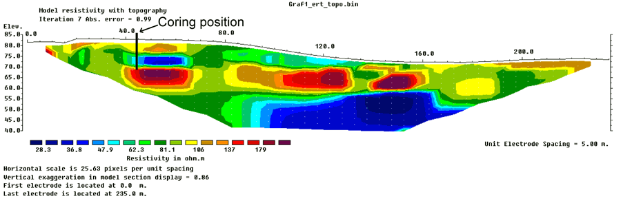 Earth resistivity model of subsurface near Düsseldorf-Grafenberg. Graphic: Timo Willershäuser / Peter Fischer |
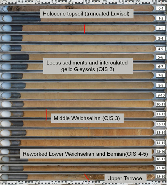 Drill core (GRAF 2) near Düsseldorf-Grafenberg. Drill core (GRAF 2) near Düsseldorf-Grafenberg. Photo: Peter Fischer |


