My PhD is about the reconstruction of Upper Palaeolithic living environments. The GEOPAL project aims to investigate which kind of surroundings our ancestors preferred roughly between 40.000 and 10.000 BC and tries to answer the question how those specific surroundings could have looked like. Therefore, we combine topographical analyses with archaeological databases, which are generated since the past 10 years. I am currently working on a comparison of different ways to classify landscapes (Fig.1), in order to find the most appropriate method for our needs.
Of course, landscapes have changed since Palaeolithic periods through the influence of modern humans, for example by mining raw materials in quarries and gravel pits, which should not be represented in our classification. This problem can be solved by choosing a coarser scale, but an oversimplification might also not represent the landscape’s state during the late Pleistocene.
Within the GEOPAL project, we aim to understand how representative our modern landscapes are for their respective paleoenvironmental reconstruction throughout Palaeolithic periods. It turned out, that most of the terrain can be used for our analysis. Further, we first must classify the landscape, so then we can apply archaeological databases that include different “cultures” of anatomical modern humans in Europe for various time periods. That followed, we determine where archaeological sites are located in the landscape and to which kind of environments people had access to. By this method, we hope to find out if the people, associated to different technocomplexes/industries, preferred different living conditions and if these changed through time.
Text: Jonathan Schoenenberg
Jonathan Schoenenberg is an affiliated member of the CRC in the D1-project. He is part of the GEOPAL project and is working on geotope reconstruction and is investgating the bioeconomic potential in Palaeolithic site territories.
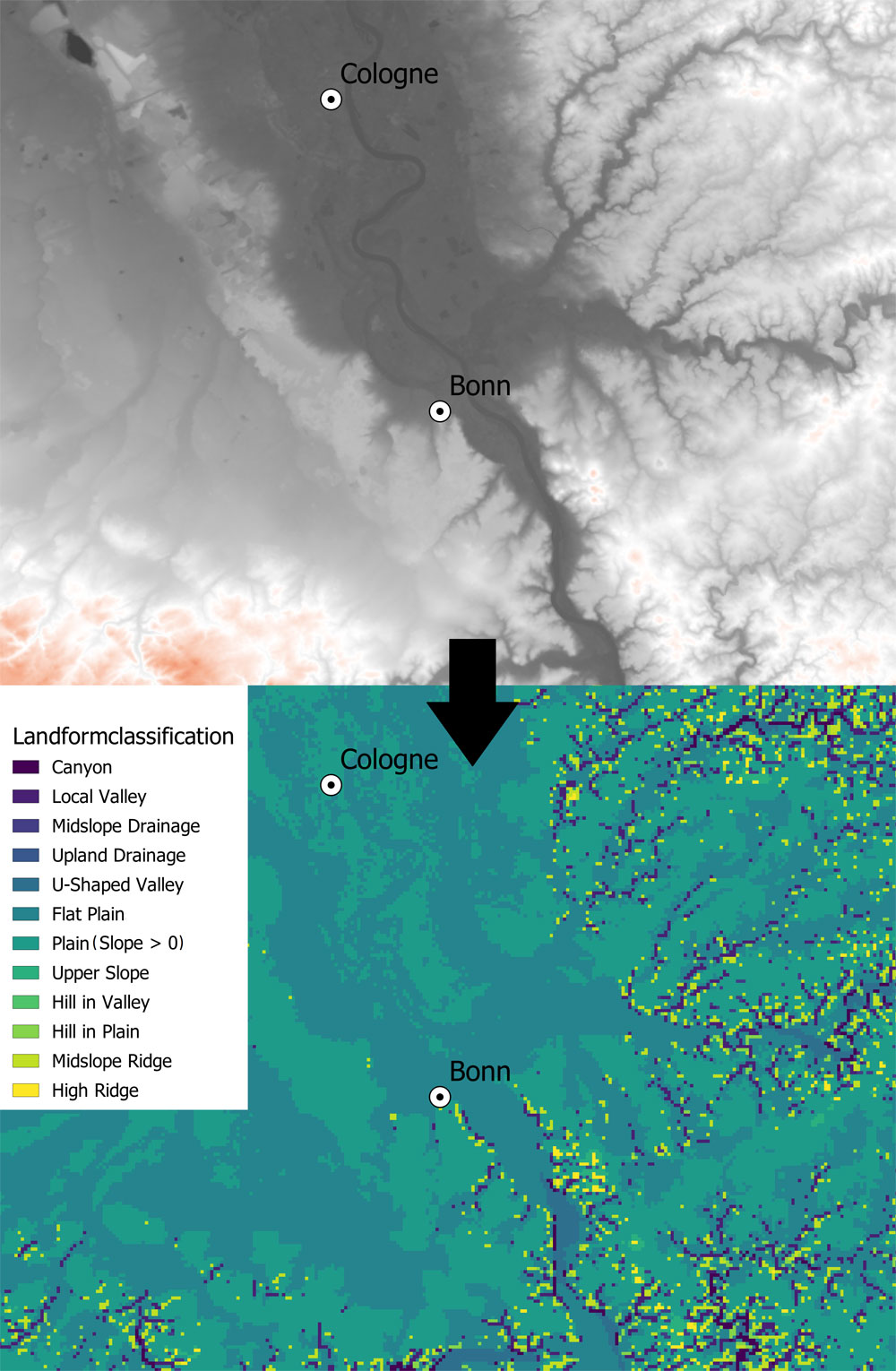 Landformclassification of the Rheinland between Bonn and Cologne, generated from a digital elevation model. Landformclassification of the Rheinland between Bonn and Cologne, generated from a digital elevation model.Figure: J. Schoenenberg |


