Together with project F1 a field campaign in Jordan was conducted in March 2010. Geomorphological and archaeological investigations, as well as terrestrial laser scanning (TLS) and DGPS surveys were carried out to clarify the intricacy of so called “Neolithic rubble layers”.
Furthermore, the current condition of Neolithic sites was determined (‘Ain Ghazal, Ba‘ja, Basta and ‘Ain Jammam).
TLS is an active remote sensing technique that is capable of direct range measurements between the laser scanner and reflecting targets. The results are highly accurate 3D point clouds which can be used to establish accurate and highly detailed 3D-models or 2D-maps. After merging data from different scan positions and cleaning the 3D-point clouds, containing millions of points, the data can be further analyzed. The accurate measurements allow a preservation of the current status as well as the reconstruction of these Neolithic sites. Thickness and distribution of rubble event layers are determined.
Fieldwork was carried in cooperation with Dr. H.G.K. Gebel (FU Berlin), Dipl.-Ing. Moritz Kinzel (TU Berlin), and Prof. Dr. C. Zielhofer (University of Leipzig).
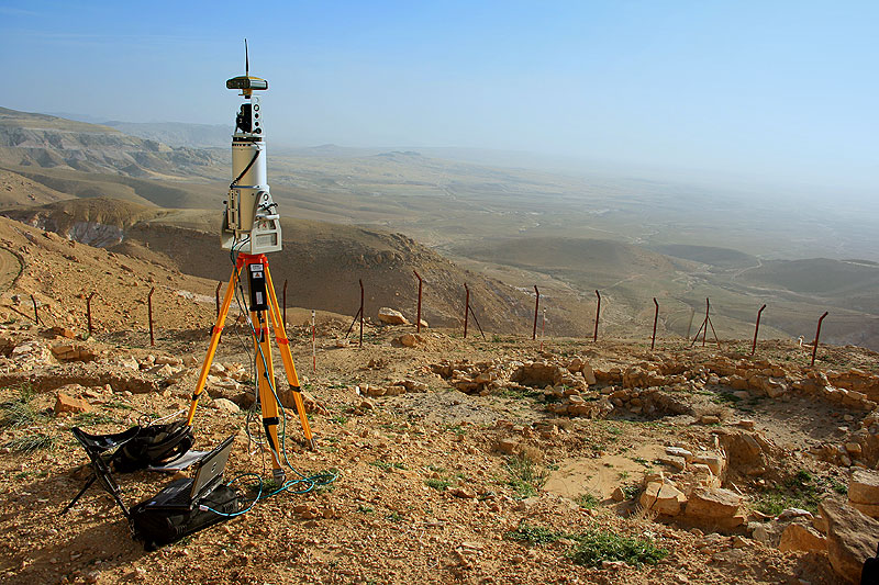 Terrestrial laser scanner in front of the Neolithic site of ‘Ain Jammam, Jordan. Photo: Dirk Hoffmeister |


