Final Report
State of knowledge and initial science questions during the second proposal
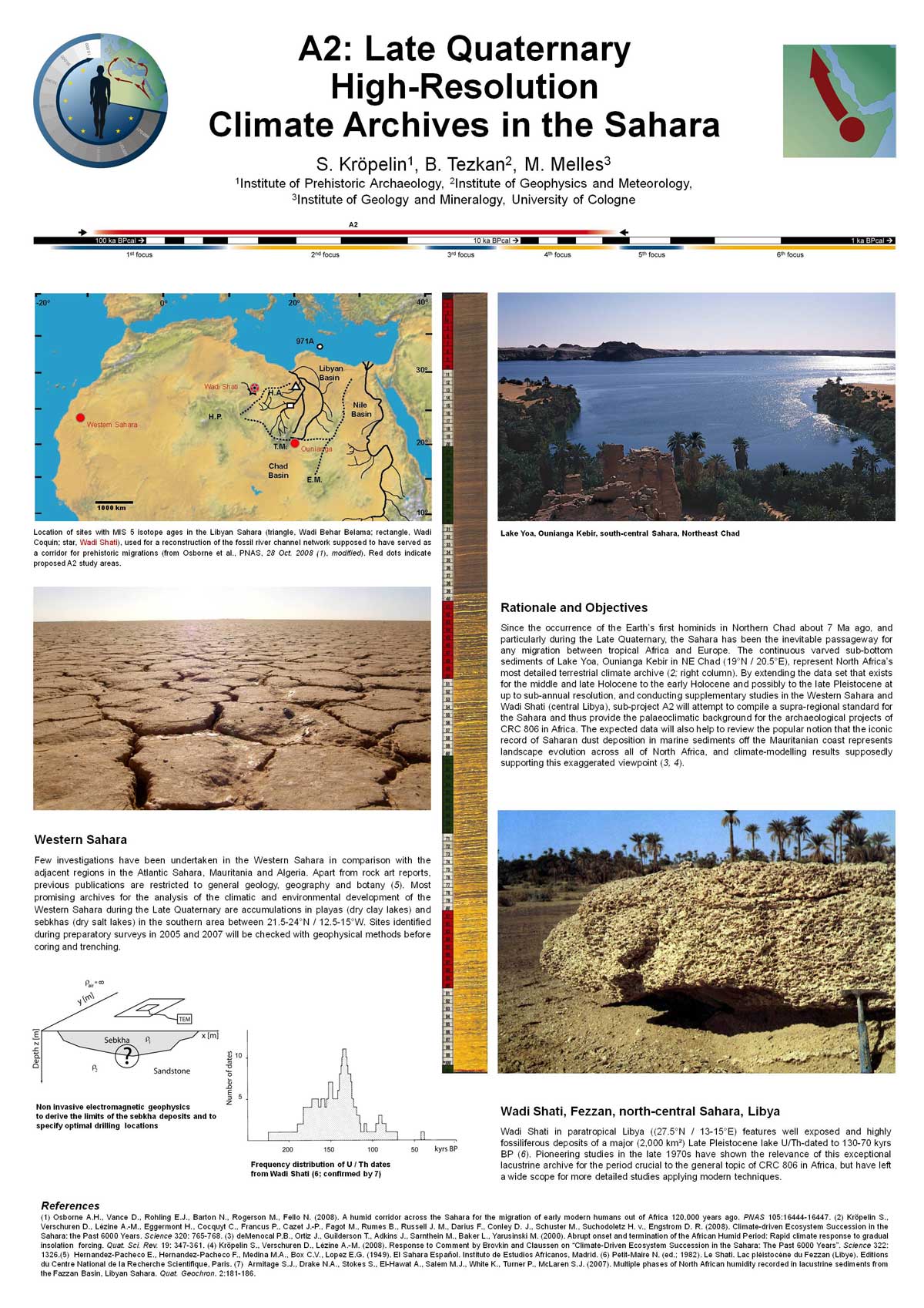
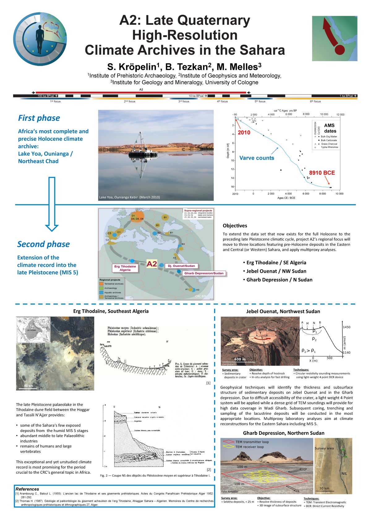
The Sahara was the inevitable passageway for any migration from tropical Africa to Europe during the Late Quaternary. By trying to extend the data set that now exists for the entire Holocene from Lake Yoa (Chad) to the preceding late Pleistocene climatic cycle, project A2 has continued to compile terrestrial data in the central Sahara to provide a palaeoclimatic standard for the CRC’s archaeological studies in northern Africa. This objective was approached by a regional extension of fieldwork to locations featuring Holocene to pre-Holocene deposits in Northern Chad and their multiproxy analysis.
Methods and Results
Geology and Archaeology
Two research expeditions in the Tibesti Mountains in February/March 2015 and 2016 opened a new chapter in the reconstruction of the last climatic cycles in the central Sahara and their palaeolacustrine environments. The Tibesti, the Sahara’s largest and highest mountains, may be considered the lighthouse and water tower for migration from sub-Saharan Africa to the Mediterranean coast and beyond from the Palaeolithic to the present. Lacustrine deposits in its varied craters are expected to extend the Holocene data set to the preceding late Pleistocene humid period.
In winter 2015, complete lacustrine sections were sampled for the very first time at the flanks of the 900 m deep crater of the Trou au Natron at the foot of Pic Toussidé, and in the 800 m deep crater of Era Kohor, the major sub-caldera of Emi Koussi, the Sahara’s highest peak (3,445 m a.s.l.). The sampled diatomites are located 360 and 125 m above the present-day bottom of the calderas. Studies in the 1960s suggested that lake levels in the Trou au Natron were 300-500 m high at 12,400-14,970 uncal. yrs BP. However, such lake depths and resulting water volumes, are hardly conceivable in view of the limited intake area and precipitation-evaporation ratios, which would have required local rainfall by far surpassing estimates for latitudes 19-21° N from the Holocene record of Lake Yoa that is situated from 220 km to 460 km southeast and 1,550 m to 2,450 m lower.
Read more ...


")

")
