It is hard to believe: We have sent a probe 500 million km to a comet to analyze rock samples, but no geologist has yet dug his spade into the crater of the highest mountain of the planet's major desert.
In mid-February 2015, a team of project A2 will leave N'Djaména for a c. 1000 km off-road journey to the Tibesti mountains of northern Chad, a lonely volcanic region covering more than 100,000 km2. The logistically challenging venture will include a two-week hike with 10 camels through the rough volcanic landscape of the still active shield volcano of Emi Koussi (3,445 m asl), the highest peak of the Sahara, and face night-time temperatures down to -15 °C (in contrast to the common up to +50 °C in the lowlands).
The main objective of the multidisciplinary field party (quaternary geology, archaeology, botany, biology) is to take the first lacustrine samples from the bottom of Emi Koussi's 800 m deep crater for dating and analysis with state-of-the-art techniques. Holocene and late Pleistocene lake deposits in other craters such as the c. 1000 m deep Trou of Natron of Pic Toussidé (3,315 m asl) shall also be sampled. Furthermore, conditions for a new geoscientific research station in the oasis of Bardai will be checked in reliable collaboration with Dr. Baba Mallaye (World Heritage Technical Committee) and Chadian ministries.
The team members expect insights into the central Sahara's humid periods during the past 200,000 years to reconstruct the environments modern humans faced on their way from Africa to Europe – a focal issue of CRC 806 "Our Way to Europe".
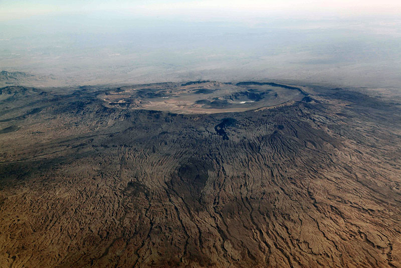 Emi Koussi (3,445 m) and its craters in the Tibesti mountains of northern Chad. Photo: Stefan Kröpelin |
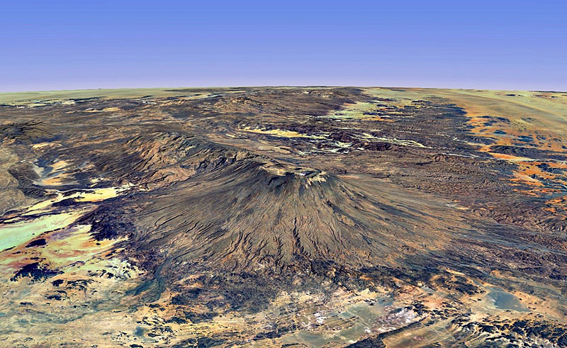 Satellite view of Emi Koussi volcano and the southeastern Tibesti. Satellite view of Emi Koussi volcano and the southeastern Tibesti.Source: Worldwind 3D |
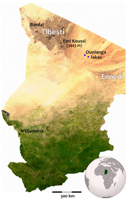 Map of Chad showing the expedition's main destinations. Map of Chad showing the expedition's main destinations. |


")

")
