A new research entitled “Combining geomorphological-hydrological analyses and the location of settlement and raw material sites – a case study on understanding prehistoric human settlement activity in the southwestern Ethiopian Highlands” was recently published at the E&G Quaternary Science Journal by members of Project A1.
In this study, the hydrological systems of Mt. Sodicho, Mt. Damota and the Bisare River catchment are analysed with regard to their influence on the preservation of archaeological sites and the accessibility of obsidian raw materials. Widespread soil erosion, badland formation and the increased human impact are discussed as well. The study is based on the results of geomorphological and archaeological field surveys that were combined with geomorphological-hydrological analyses. In addition to mapping archaeological sites and lithic raw material sources, research tools such as remote sensing, geographical information systems and radiocarbon dating were used.
The complete article is available at https://doi.org/10.5194/egqsj-68-201-2019 and supplementary data sets can be requested from the CRC 806 Database (DOI: 10.5880/SFB806.49).
Reference: Hensel, E. A., Bödeker, O., Bubenzer, O., and Vogelsang, R.: Combining geomorphological-hydrological analyses and the location of settlement and raw material sites – a case study on understanding prehistoric human settlement activity in the southwestern Ethiopian Highlands, E&G Quaternary Sci. J., 68, 201–213, https://doi.org/10.5194/egqsj-68-201-2019, 2019.
Text: Elena Hensel
Elena Hensel is a PhD-candidate in the A1-project. She is working on palaeoenvironmental reconstructions in southwest Ethiopia with a selection of geoarchaeological analyses.
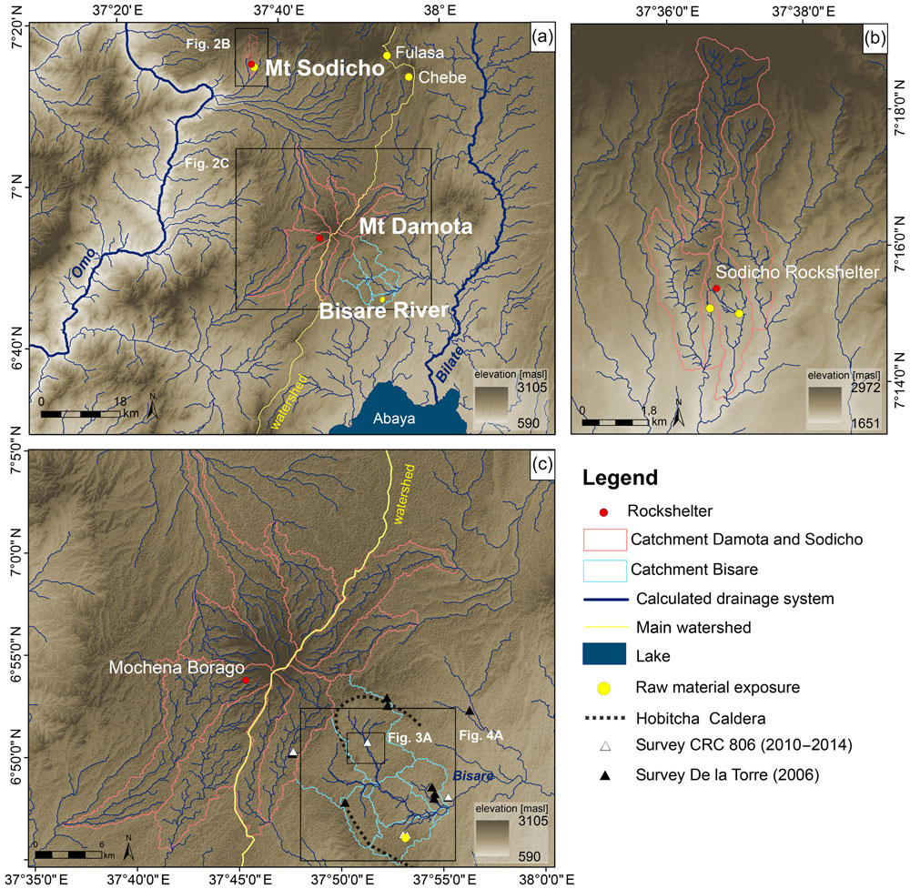 Calculated drainage networks and mapped raw material exposure in the study area. Calculated drainage networks and mapped raw material exposure in the study area.Figure: Hensel et al. 2019 |


")

")

")


