The Mediterranean littoral west of the Melilla Peninsula and the mountainous hinterland is a very extensive territory. Archaeological surveys within this inaccessible area are tough and time consuming.
From our experience in the last years we were also aware that an intensive pastoral economy in the region has resulted in the erosion of many open air sites, with archaeological deposits surviving more or less exclusively in caves or rock shelters. These structures have formed mainly within the limestone deposits. In order to reduce the overall survey area limestone outcrops were mapped (Bachelor thesis by Anna Maren Roeloffs, RWTH Aachen). Topographic maps were scanned, geological maps were digitised, and the distribution of limestone outcrops projected onto the topographical maps. High-resolution “Quick-Bird” satellite images were added to produce maps for final surveys that were then conducted on the ground. This resulted in a more systematic survey; the survey area was reduced to just 5 % of its previous size. A large number of caves and shelters (with and without archaeological deposits) were located.
Publication:
A. Roeloffs, J. Linstädter, T. Wiatr, K. Reicherter and G.-Chr. Weniger
Prospection of karstic caves using GIS and remote-sensing techniques for geoarchaeological research, NE-Morocco.
In: V. Lenz-Wiedemann and G. Bareth (Eds.), Proceedings on the Workshop of Remote Sensing Methods for Change Detection and Process Modelling, Cologne, 18.–19.11.2010. Kölner Geographische Arbeiten 92, 2011, 121–129. DOI: 10.5880/TR32DB.KGA92.16
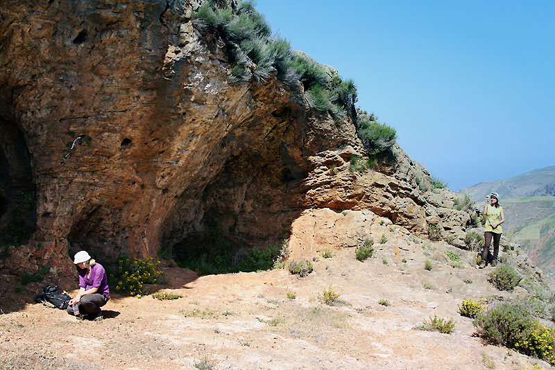 Survey of a rock shelter near the Mediterranean littoral west of Oued Kert (Anna Maren Roeloffs, Oumayma Aber). Survey of a rock shelter near the Mediterranean littoral west of Oued Kert (Anna Maren Roeloffs, Oumayma Aber).Photo: Jörg Linstädter |
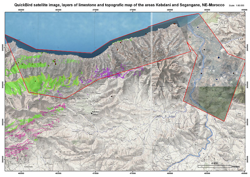 Combined map showing topography, carstic areas and archaeological sites. Source: Roeloffs et al. 2011, fig. 5c |

 in caves of Morocco")


 NE-Morocco")

, NE-Morocco")


")
 in Nador (Morocco)")

